
Friday, August 29, 2014
Wednesday, August 20, 2014
Pictures from the wedding
Almost ready.

Tables under Rob's tent.


Ana, Selena and Dad.

Wny we were there.

A wedding crasher.

The Ring Bear.


And the rings.

Aunt Kay and Cousins Mary, Ann and Kay.

Uncle Larry and Uncle Tom.

Gimbal.

It's too bad this is blurry, but Liz looks so happy, I had to post it anyway.

The Cool Cousins, or so they claim.

Trevor's toast.

Dancing.

Cousins.

Liz shows Aunt Kay her September 11 weaving.

The aftermath.

Tables under Rob's tent.
Dad's not in the picture because he was doing this:
Peter is always chic.
Flower children.
Ana, Selena and Dad.
Wny we were there.
A wedding crasher.
The Ring Bear.
And the rings.
Aunt Kay and Cousins Mary, Ann and Kay.
Gimbal.
It's too bad this is blurry, but Liz looks so happy, I had to post it anyway.
The Cool Cousins, or so they claim.
Trevor's toast.
Dancing.
Cousins.
Liz shows Aunt Kay her September 11 weaving.
The aftermath.
Monday, August 18, 2014
August 9, 2014
This would have been Grandma Frey's 86th birthday, and how she would have relished the fun and anticipation of arriving in Olympia and preparing for the Big Event.
We picked up Caleb and Kate at Sea-Tac on Saturday morning and checked into our house on Totten Inlet, about 15 minutes north of Liz's house on one of the several spits of land that extend northward into the tidal waters of Puget Sound. Here's the view from the deck:

Those are mussel rafts visible on the water not far off the shore. That whole area of the sound is leased by a commercial shellfishing operation that farms oysters, mussels, geoducks and I don't know what else. We saw the rafts tended by small boats each day during the week of our stay.

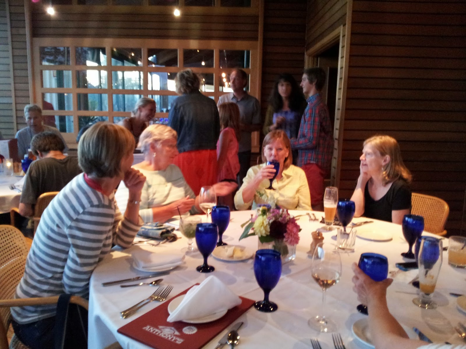
On Saturday night, we gathered for a night-before dinner with relatives and friends who were arriving from afar at Anthony's Homeport on the water on Olympia. Visible here from the right: Rob's sister Bonnie, Tom, Rob, Liz, Liz's friends Deb, Robin and Marty, and Robin's daughter Emmy.

In the background -- Cantys, Clancys, a Recktenwald, some Freys and Murphies, and glimpses of Misa, Olivia, Rob's mother Karen, and Luke, who got into Seattle on Saturday evening just in time to make it to the restaurant with Anna, Laura and Jason.

Ana, Alex, Trevor and Chris.

Aunt Kay Canty and cousins Caker Canty Deasy, Ann Clancy Lee and Kay Clancy. (That's three out of four variants on Catherine, by the way, and not the only ones who were present. This WAS a Frey family wedding.)
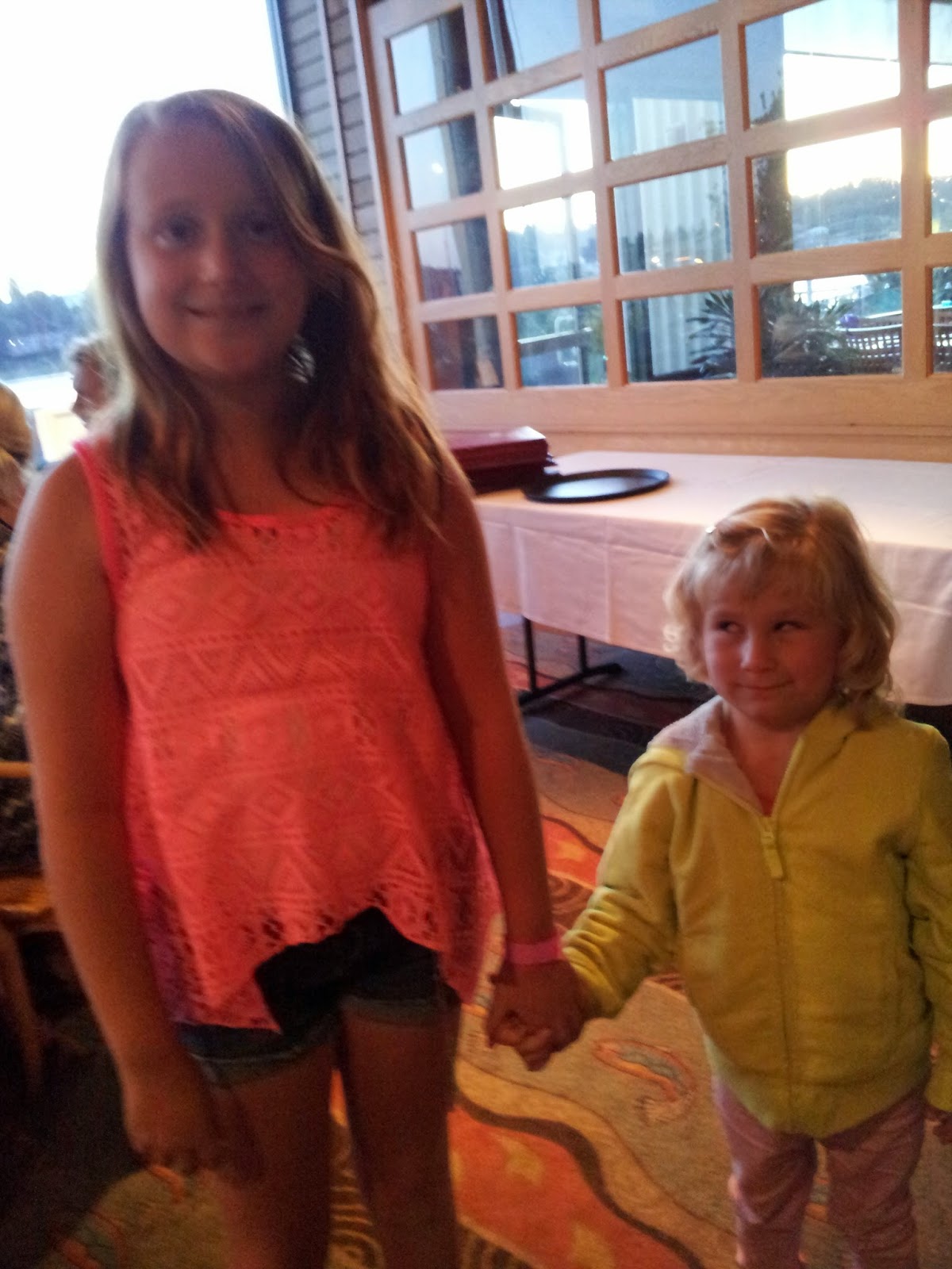
Cousins! So cute! And they both look just like their fathers did at their respective ages.
Fast forward to tonight, August 18th: we're in Fort Wayne, Indiana, with one day's traveling left ahead of us to get home tomorrow night. This morning, we drove through a misty, overcast Minnesota and Wisconsin into Illinois and arrived in early afternoon at the St. James Farm Forest Preserve of DuPage County, where "I Saw a Child," a bas-relief sculpture of Grandma Frey's, is exhibited on the wall of the elegant brick stable. I'll post pictures of that -- and of The Wedding -- tomorrow!
Day Two of the Epic cross-country Trip
Today is really Day Three, but I didn't do Day Two, so I'm catching up. Day Two started in Big Timer MT and ended in a very odd Best Western in Minneapolis. 900 miles in 12.25 hours. Mostly Montana and North Dakota. Then Minnesota. I'll do today tomorrow.
On the way home
I'm out of time sequence now, but I'll catch up when I can after we get home. Here's sunrise on the Crazy Mountains, from the parking lot of a Super 8 early this morning in Big Timber, Montana:

And here, not all that visible, is the signature of William Clark of the Lewis and Clark expedition, dated 1806, on Pompey's Pillar, a rock formation visited by Lewis and Clark, and covered with Native American pictographs and the signatures of pioneers, along the Yellowstone River in southern Montana on our way from Big Timber to Glendive:


These are the North Dakota Badlands, in the Theodore Roosevelt National Park along I-94 in western North Dakota:
 x
x

 We passed more oil drilling in southern North Dakota, though not as much as we'd seen up near Williston. Then we rolled across the crop fields of the rest of the state, past the lakes of northern Minnesota and down near Minneapolis, where we're spending tonight. Tomorrow, with luck, we'll reach Indiana, then home on Tuesday night.

And here, not all that visible, is the signature of William Clark of the Lewis and Clark expedition, dated 1806, on Pompey's Pillar, a rock formation visited by Lewis and Clark, and covered with Native American pictographs and the signatures of pioneers, along the Yellowstone River in southern Montana on our way from Big Timber to Glendive:

We climbed the boardwalk steps onto the rock formation so early that the park office wasn't open yet, and the ranger that we met was buzzing around in a golf cart getting ready for the day. We mentioned the mosquitoes swarming all around us, and he said yes, that was the real Lewis and Clark experience, which they complained about all the time. I looked it up tonight, and sure enough, their journals are full of comments on the "troublesome," "very troublesome" and "extremely troublesome" mesquestors, misquestors, misquitor, misquitoes, misquitors, misqutors, misqutr, missquetors, mosquiters, mosquitors, mosquitos, muskeetor, musqueters, musquetors, musquiters, musquitoes, musquitors, musqueters, and musqutors. (That's every spelling in the journals, as enumerated by a scholar.)
Pioneer writings on the rock:

These are the North Dakota Badlands, in the Theodore Roosevelt National Park along I-94 in western North Dakota:


Sunday, August 17, 2014
A whole lot of blogging to do
As Dad points out, I am way behind. It isn't just because it's time-consuming, it's also because the internet connection at our eccentric semi-Asian-decor, seal-view house on Totten Inlet in Olympia was really really slooooooow and trying to get it to upload a bunch of photographs would have made me even crazier than I already am. Also, I haven't transferred the photos in my "real" camera to the computer yet, and there are a lot of them.
Howsomever. Here are some photos from August 8, the last day of our trip west, in which we drove from Moses Lake, Washington to Olympia. We took I90 west, traveling across the immense basin scoured through the center of the state by the repeated emptying of glacial Lake Missoula when its ice dams broke over and over again around 15,000 B.C. The Columbia River occupies a deep gorge remaining from that cascade of water, which began in Montana and flooded its way to the Pacific. Here's Dad overlooking the gorge and the river in Vantage, Washington, where I90 crosses the river just below the still-visible site of an old ferry crossing.

Just across the river is the Gingko Petrified Forest State Park, where we took a quick look at petrified wood from forests that grew millions of years ago.


Then we drove down to the point where I82 swings south toward Yakima, and stopped at a rest area to photograph distant smoke from forest fires in the mountains

and nearby scarring from a forest fire on the ridge just above the rest area

and a firebreak carved by a bulldozer to keep the fire from reaching the rest area and the highway.

We drove west from Yakima on Route 12 through stunningly beautiful mountains and forests in the Cascace Mountains. This is Rimrock Lake.

And this is Mount Rainier, seen from afar from an overlook on Route 12. We planned to go back for a closer look, but as it turned out the weather didn't cooperate, and this was as close as we got:

 Not close enough. We'll have to go back.
That night, we arrived in Olympia, drove over to Liz's flowery house in the midst of busy wedding preparations that included the building of a homemade tent and fence, unloaded Liz's boxes and sculptures, and shared a fine salmon dinner and an evening around the firepit with Liz, Rob, members of Rob's family, Ana, Selena, Chris, Eszter, Trevor, Alex, and I don't remember who else before returning to the hotel for a well-earned rest. Next: our house on Totten Inlet, the night before the big event, and The Wedding!!
Not close enough. We'll have to go back.
That night, we arrived in Olympia, drove over to Liz's flowery house in the midst of busy wedding preparations that included the building of a homemade tent and fence, unloaded Liz's boxes and sculptures, and shared a fine salmon dinner and an evening around the firepit with Liz, Rob, members of Rob's family, Ana, Selena, Chris, Eszter, Trevor, Alex, and I don't remember who else before returning to the hotel for a well-earned rest. Next: our house on Totten Inlet, the night before the big event, and The Wedding!!
Howsomever. Here are some photos from August 8, the last day of our trip west, in which we drove from Moses Lake, Washington to Olympia. We took I90 west, traveling across the immense basin scoured through the center of the state by the repeated emptying of glacial Lake Missoula when its ice dams broke over and over again around 15,000 B.C. The Columbia River occupies a deep gorge remaining from that cascade of water, which began in Montana and flooded its way to the Pacific. Here's Dad overlooking the gorge and the river in Vantage, Washington, where I90 crosses the river just below the still-visible site of an old ferry crossing.
Just across the river is the Gingko Petrified Forest State Park, where we took a quick look at petrified wood from forests that grew millions of years ago.
Then we drove down to the point where I82 swings south toward Yakima, and stopped at a rest area to photograph distant smoke from forest fires in the mountains
and nearby scarring from a forest fire on the ridge just above the rest area
and a firebreak carved by a bulldozer to keep the fire from reaching the rest area and the highway.
We drove west from Yakima on Route 12 through stunningly beautiful mountains and forests in the Cascace Mountains. This is Rimrock Lake.
And this is Mount Rainier, seen from afar from an overlook on Route 12. We planned to go back for a closer look, but as it turned out the weather didn't cooperate, and this was as close as we got:
Saturday, August 16, 2014
Our Mt St Helen's volunteer
This is the guy who walked up to us and asked us if we had any questions at MSH. Then he entertained us for the next half hour.
And here is a guy who survived the MSH eruption in 1980:
And here is a guy who survived the MSH eruption in 1980:
Where'd We Go?
So. Mom left off blogging more than a week ago. Me: How come you left off blogging? She: Well, it was so time consuming. It took me a couple of hours to do a post. Me: Why don't you make simpler posts? She: Oh, no, I can't do that.
So. Briefly, we went to Olympia, Washington. Our children and their spouses/whatevers joined us at a rental house on a Puget Sound inlet. We went to a wedding. We went other places, such as Seattle, and Mt St Helens. If we're lucky, Mom will make blog posts about these things as time permits.
This morning, we left for home at 7:30 PST. We drove about 800 miles over 11 hours drive time. There was an additional hour of stoppage time (for all you soccer fans). We arrived at the Super 8 in Big Timber MT, at 8:30 pm MT. We averaged about 72 MPH and 18 MPG for the day.
Montana is staggeringly beautiful.
Thursday, August 07, 2014
Montana to Idaho to Washington
We left Flathead Lake early and drove south on 93 through the Flathead Indian Reservation, bordered on the east by the high wall of the Mission Range of the Rocky Mountains, into the National Bison Range. There, three to four hundred bison live in a small mountain refuge that has been protected since the early 20th century. We spent two or three hours driving on the gravel loop road that climbs through grassland into mountain terrain where the bison live, along with pronghorn antelope, eagles, mule deer and (we're told, though we didn't see them) elk, mountain lions, bobcats and bears.
The visitors' center has this:

Scenes from the narrow, one-way mountain road:

A buffalo wallow:


The visitors' center has this:
Scenes from the narrow, one-way mountain road:
A buffalo wallow:
Pronghorn antelope were plentiful, but we reached the highest point in the park -- just under 5000 feet -- without having seen any buffalo. Well, bison, really, but even the interpretive signs in the park visitors' center call them buffalo, after carefully explaining the difference.
However, the views were worth it. The refuge is a spur of the Mission Mountain range lying in a huge flat valley, the remnants of glacial Lake Missoula. You climb through gullies and over ridges through a series of switchbacks to the highest point, just under 5000 feet above sea level, looking out in all directions over ranchlands, lakes, gullies, rivers and forests on the valley floor below and mountain ranges bordering the distance. The dry Western sun feels wonderfully hot on your shoulders, so high up, so close to the sky, with a breeze always blowing and the whole world at your feet.
We could smell smoke on the air and see a dark haze filling the mountain valleys to the west. More about that later. Driving down from the summit, we finally spotted bison: a few strays here and there, then the large herd grazing too far off to look like more than interesting dots, and finally this guy, resting in a dusty wallow fairly near the road:
I think we saw an eagle, too, flapping slowly near the ground.
We left the bison refuge and turned west on Montana 200 along the stunningly beautiful Flathead River, a flow of that same Rocky Mountain crystalline aquamarine water we saw in Glacier, bordered by high sandy hills studded with Ponderosa pines. We were headed for Thompson Falls, where we planned to cross into Idaho via Thompson Pass. But before we got there -- fire! We found ourselves on route 200 passing just under the forest fires we'd seen from the bison refuge, burning in forests on top of steep rocky bluffs and mountains.
We drove right below the fires, close to flames and embers, past a sign warning motorists not to stop because of the danger of rolling debris, under two or three helicopters buzzing back and forth to the river filling huge buckets that they lugged back up to the mountain tops and then dumped on the fires in seemingly useless streams -- so little, compared to all that smoke and flame. At least one airplane flew through the smoke, too, dumping -- as we later learned -- fire retardant. We passed a parking area of firetrucks and firefighter buses, and when we left the fires behind and reached the next town, saw signs directing firefighters to a sleeping area. It turns out the fires have been burning since August 1, following lightning strikes in a series of storms, and because of the rugged terrain, if the dry, hot weather doesn't change, may burn - contained but not extinguished by the firefighters -- for several weeks.
We left the fires behind, drove through Thompson Falls, and climbed along a narrow, twisting creek higher and higher toward Idaho. We were near the top when Montana gave us one last gift: a quick glimpse of a young bear, a pre-teenager, I'd guess, glossy and fast-moving, galumphing across the road to the shelter of the woods. Black, well-fed, strong and happy-looking. We were happy, too.
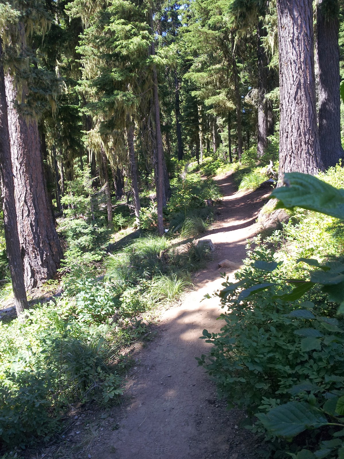
Thompson Pass is a lovely place, a narrow mountain pass that is closed in winter by snowdrifts but, in summer, is a glory of views, wildflowers, trails and happy hikers picking huckleberries.
We drove down and down and down and down from the pass into Idaho, past a river bordered for miles by RV camps filled with what seemed to be hundreds of campers and trailers, lined up along the stream with hammocks, grills, swings, tents and canopies on the shore and swimmers and fishermen and rafts and kayaks full of happy kids bobbing in the river shallows, everywhere you looked for miles. Funland!
Then we reached I90 west, made short work of a steep climb through the rest of Idaho -- with a quick stop at a Walgreens for an Idaho keychain for Ana -- and drove a couple of hours out of the mountains and across the grasslands of the Columbia Basin in Washington State, where we're spending the night in a resort town called Moses Lake. Views from the sliding glass doors of our motel room as evening gathers:
We'll be in Olympia by tomorrow evening. Time to shift our thoughts from traveling to wedding preparations and family.
Subscribe to:
Posts (Atom)