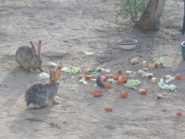
That was this morning's view from our hotel room in Limon, Colorado. And a little later, in the parking lot, I heard the astonishingly sweet song of a Western Meadowlark, so pure and clear that I thought at first it was some kind of recording playing from the hotel or my phone. Too beautiful to be real -- but it was!
There are a great many windmills in eastern Colorado. Not quite as many as in Texas, but nevertheless, quite a few. Here and there among the high-tech giants you can still spot an occasional "real" windmill, the old-fashioned ones so familiar from cowboy movies, dwarfed by their modern offspring. I tried to catch a picture of one such juxtaposition, but from the moving car, it didn't work out as well as I hoped:
I like this one better, because it makes the old windmill look bigger than the new ones. I don't know what that little thing is on the right -- a water pump with a bucket, maybe?
Anyway, our route today was less splendid than some of the others, but every bit as lovely. Here it is:
As you can see, we started in Colorado, drove all the way across Kansas and ended the trip in Missouri. We left at 7:30 a.m. and arrived at 6 p.m., more or less. Allowing for stops along the way and a lost hour from the time zone change, we were on the road for about 8 1/2 hours. We happily eschewed the Interstate for most of the way, taking I70 into Kansas but then making most of the rest of the trip on US 36, an open, lightly-traveled road with a speed limit of 65 for most of the way, running straight as a ribbon through mile after mile of farmland and, every now and then, a very small town with a grain elevator, some cottonwood trees, maybe a convenience store or two and homes for maybe 300 people. US 36 was once part of the Pikes Peak Ocean to Ocean Highway, a pre-Interstate cross-continental highway running from New York to California. Now it runs from Colorado to Ohio. Peaceful, interesting and SO much better than doing battle with trucks on the Interstate! We'll drive on more of it tomorrow.
It was overcast and misty much of the way, so I didn't take many pictures. But here's our entry to Kansas at 8:51 a.m. Mountain Daylight Time:
And here we are departing at 5:19 p.m. Central Daylight Time:
In between, we watched the landscape gradually transition from dry, high-desert grasslands studded with cacti and sunflowers to greener fields of sorghum, soybeans and wheat helped along by irrigation and finally to the water-rich greenery of the countryside around the Missouri River. At some point along the way, the feel of the landscape changed from the West to the East.
And, also along the way, we passed through Lebanon, Kansas, marked on our (excellent) folding paper map of the State of Kansas as the Geographical Center of the Contiguous United States (that is, not including Alaska and Hawaii). As we drove toward Lebanon, we speculated at length on how geographers might have figured out where the center of a huge, very irregularly-shaped country might be. I thought it might involve finding the farthest points to the north, south, east and west and determining the point where lines drawn between them intersected, while Dad had a far more mathematically complex idea about determining radii from each outermost point and finding the spot where half the radii were shorter and half were longer -- though I'm sure I'm not describing that accurately. But then we arrived at this historical marker and discovered how it was really done:
However, the plot thickens, because also marked on our handy-dandy map just a few miles south of the Geographic Center, we also spotted a second marker for another center: the GEODETIC Center of the United States, which was apparently identified by the US Coast and Geodetic Survey in 1901 to be used a consistent reference point for all other measurements of the US. This was getting to be too many Centers and more than a little bewildering, especially since we remember visiting yet another Geographical Center of the United States, located in South Dakota. (That one, it turns out, includes Alaska and Hawaii. There's a post about it somewhere on this blog and I'll update when I find it.)
It turns out that we aren't the only ones who are confused. Here's one more article from Atlas Obscura describing all three of the centers and trying to sort them out. The article includes this map, with the charming caption, "So Many Centers."
But that's more than enough about centers for today. Tomorrow we're setting off again on US 36 eastbound, heading for Indiana. Almost home!


.jpg)


