
That was this morning's view from our hotel room in Limon, Colorado. And a little later, in the parking lot, I heard the astonishingly sweet song of a Western Meadowlark, so pure and clear that I thought at first it was some kind of recording playing from the hotel or my phone. Too beautiful to be real -- but it was!
There are a great many windmills in eastern Colorado. Not quite as many as in Texas, but nevertheless, quite a few. Here and there among the high-tech giants you can still spot an occasional "real" windmill, the old-fashioned ones so familiar from cowboy movies, dwarfed by their modern offspring. I tried to catch a picture of one such juxtaposition, but from the moving car, it didn't work out as well as I hoped:

I like this one better, because it makes the old windmill look bigger than the new ones. I don't know what that little thing is on the right -- a water pump with a bucket, maybe?

Anyway, our route today was less splendid than some of the others, but every bit as lovely. Here it is:

As you can see, we started in Colorado, drove all the way across Kansas and ended the trip in Missouri. We left at 7:30 a.m. and arrived at 6 p.m., more or less. Allowing for stops along the way and a lost hour from the time zone change, we were on the road for about 8 1/2 hours. We happily eschewed the Interstate for most of the way, taking I70 into Kansas but then making most of the rest of the trip on US 36, an open, lightly-traveled road with a speed limit of 65 for most of the way, running straight as a ribbon through mile after mile of farmland and, every now and then, a very small town with a grain elevator, some cottonwood trees, maybe a convenience store or two and homes for maybe 300 people. US 36 was once part of the Pikes Peak Ocean to Ocean Highway, a pre-Interstate cross-continental highway running from New York to California. Now it runs from Colorado to Ohio. Peaceful, interesting and SO much better than doing battle with trucks on the Interstate! We'll drive on more of it tomorrow.
It was overcast and misty much of the way, so I didn't take many pictures. But here's our entry to Kansas at 8:51 a.m. Mountain Daylight Time:

And here we are departing at 5:19 p.m. Central Daylight Time:

In between, we watched the landscape gradually transition from dry, high-desert grasslands studded with cacti and sunflowers to greener fields of sorghum, soybeans and wheat helped along by irrigation and finally to the water-rich greenery of the countryside around the Missouri River. At some point along the way, the feel of the landscape changed from the West to the East.
And, also along the way, we passed through Lebanon, Kansas, marked on our (excellent) folding paper map of the State of Kansas as the Geographical Center of the Contiguous United States (that is, not including Alaska and Hawaii). As we drove toward Lebanon, we speculated at length on how geographers might have figured out where the center of a huge, very irregularly-shaped country might be. I thought it might involve finding the farthest points to the north, south, east and west and determining the point where lines drawn between them intersected, while Dad had a far more mathematically complex idea about determining radii from each outermost point and finding the spot where half the radii were shorter and half were longer -- though I'm sure I'm not describing that accurately. But then we arrived at this historical marker and discovered how it was really done:

However, the plot thickens, because also marked on our handy-dandy map just a few miles south of the Geographic Center, we also spotted a second marker for another center: the GEODETIC Center of the United States, which was apparently identified by the US Coast and Geodetic Survey in 1901 to be used a consistent reference point for all other measurements of the US. This was getting to be too many Centers and more than a little bewildering, especially since we remember visiting yet another Geographical Center of the United States, located in South Dakota. (That one, it turns out, includes Alaska and Hawaii. There's a post about it somewhere on this blog and I'll update when I find it.)
It turns out that we aren't the only ones who are confused. Here's one more article from Atlas Obscura describing all three of the centers and trying to sort them out. The article includes this map, with the charming caption, "So Many Centers."

But that's more than enough about centers for today. Tomorrow we're setting off again on US 36 eastbound, heading for Indiana. Almost home!
Margot, this post is about something you're interested in: bunnies!
On our trip out West, Grandpa and I visited your Great Uncle Jim and Great Aunt Mary Ellen. Great Uncle Jim is Grandpa's brother. They live in California, in the desert, where it's very, very, very hot and it hardly ever rains. It's so hot and dry that instead of grass and trees and flowers like the ones that grow around your house, they have sand and desert plants like cactus and yucca, and strange plants called Joshua trees that look like something from a Dr. Seuss book.

This cactus patch is right next door to the house where Great Uncle Jim and Great Aunt Mary Ellen live. Lots of rabbits live there because they can hide under the desert plants and keep cool in the shade. Great Uncle Jim and Great Aunt Mary Ellen like the rabbits a lot and want to make sure they have enough to eat and drink, even though it's so hot and dry. So, every day, they get up early, when the sun is just coming up, and they cut up lettuce and carrots and bread to put outside for the bunnies, along with rabbit pellets and plenty of water.

Early every morning, the bunnies come to their house and wait in the yard, because they know the food is coming.


(I took these pictures from inside the house, through the window, so I wouldn't scare the bunnies away.)
And then the bunnies have their breakfast.


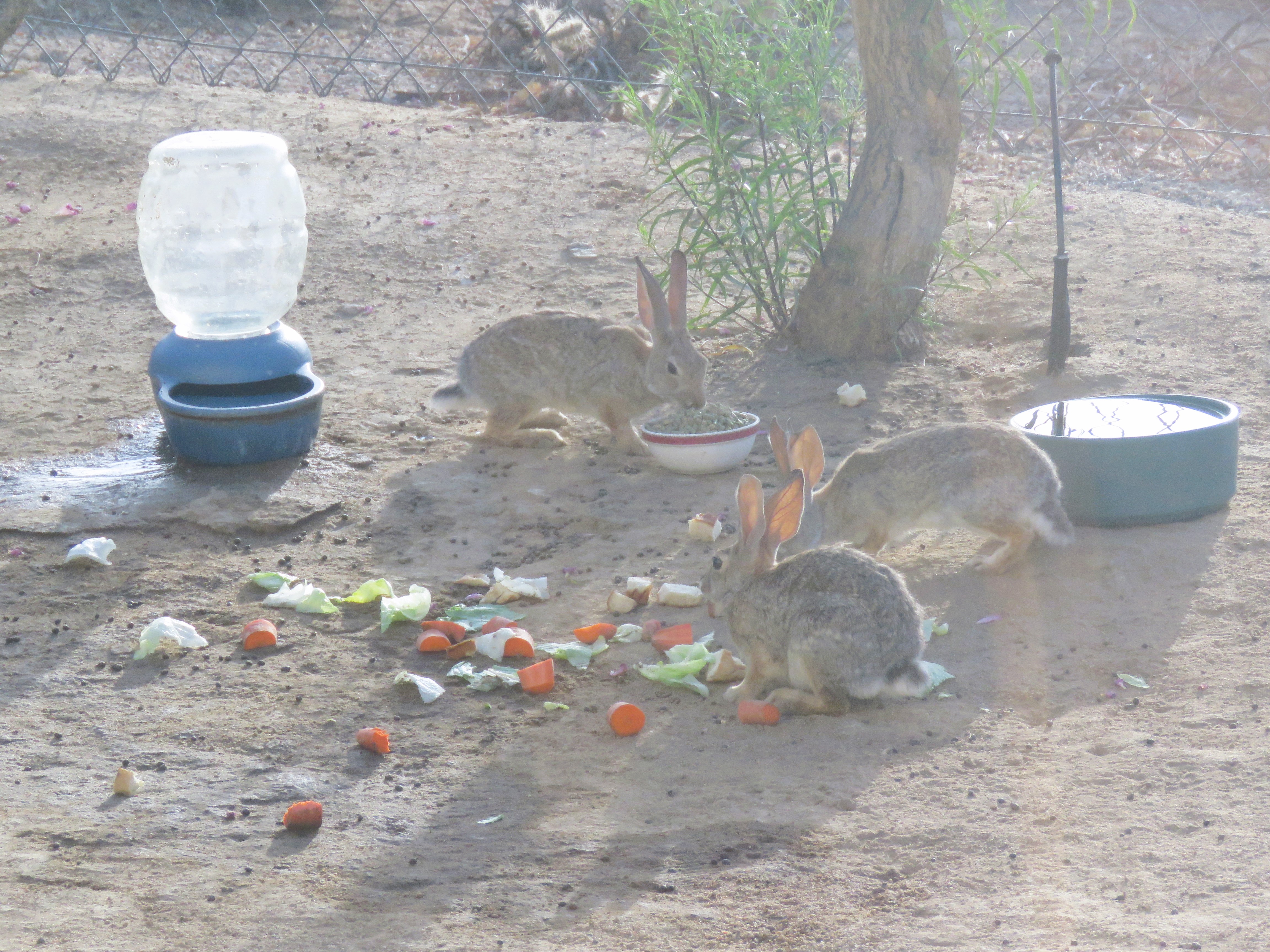

The bunnies come so regularly that Great-Uncle Jim and Great-Aunt Mary Ellen can recognize some of them. For instance, they can tell that this bunny comes every day. It's easy to recognize because it has a notch in its ear.


Anyway, we thought you might like to know about your great uncle and great aunt, who like bunnies almost as much as you do. They even have this pretty bunny tile in their house, right by the window where you can see the bunnies eating.


That's a quote from the trail register at the Amboy Crater, a volcano that we climbed today. Yes, we climbed a volcano, right into the crater. The question in the trail register was, "Why are you here?" and "VOLCANO!!!!" was somebody's highly appropriate, if excitable answer. That's why we were there, too.
First, our route for today, from Jim and Mary Ellen's to the Best Western Settler's Point at Washington, Utah, an extremely nice hotel that I'll have more to say about later.

The volcano is located where the blue line jogs from left to right, just below the I40 symbol. Here's a shot of how it looks from overhead, with hardened black basaltic lava still streaming away toward the southeast after some ancient eruption. Actually, there is much more black lava around the volcano than you can see here. It's absolutely everywhere, from big hardened outcrops to smaller stones and pebbles of black rock filled with holes, on all sides of the volcano. Apparently, the volcano last erupted 10,000 years ago and at least 3 times before that, creating what the brochure calls "nested" cinder cones within the crater.

It's in the Mojave desert, in the middle of what Jim and Mary Ellen
call "The Big Empty" -- that is, the middle of nowhere -- on the way
from their house in Yucca Valley, CA to Interstate 15 heading north
toward Nevada and Utah. You can see it from miles away, in the middle of a vast flat plain where a huge industrial surface mining operation is going on. Long, deep ditches lined both sides of the road, interrupted sometimes by large rectangular bare areas. The wind was stiff and a fine, pale dust filled the air, masking the view of the surrounding mountains. Very eerie and dystopian. Okay, it turns out that it's National Chloride Co-America and they are mining calcium chloride through some kind of liquid process. Just to give you a general idea of the weirdness of it, here are a couple of pictures, not taken by me as you can see.


Oh and, by the way, this mine and the volcano are both situated on Route 66, now known (at least in that part of California) as a National Trails Highway. Nearby is Roy's Motel and Cafe, a landmark from back in the day with vintage cars parked by its neon sign.
So, the volcano. It was 103 degrees, not ideal weather for volcano-hopping. But the sky was overcast, there was a stiff breeze cooling things down a bit, and it's only a mile from the parking area to the crater, most of it pretty level -- so we thought we'd try it. And we're glad we did!


The trail winds across rough, rocky ground interrupted with clumps of basaltic lava, and for most of the way it's flat, easy going. There were signs about wildlife that we might see, like the chuckwalla lizard that apparently likes to live in lava fields, but we did not encounter any such critters. The whole area was burned black, hot and silent, almost as if the last eruption had happened last year.

Here's where the climb to the crater begins -- you can see the switchbacks on the right-hand side. The volcano is 250 feet high, but the climb to the crater is less than that because there's a break in the crater wall where -- like Mt. St. Helens -- a past eruption blew out sideways rather than straight up. Here's the break, seen from within.


and even more clearly in this one! He said the view was spectacular. I took him at his word. I was pretty hot and wrung out, and also pleased to have made it to the crater at all. So I stayed in the crater and took photos.

I'm not going to try to cover everything else we saw today right now,
because it's too much. We had quite a day. Maybe I'll come back later to
tell you about the Kelso Sand Dunes, the Mojave Road, or the sharp acrid smell like something burning that filled the desert air after it rained a little in the afternoon making us think at first that something was wrong with the car, until we realized that the smell was everywhere and that we were smelling the creosote bushes, or chapparal, that carpeted the desert everywhere. For now, I'll just quickly show you the Red Barrel cactus we found
along the Mojave Road, the only red thing in miles and miles of sand and
olive green and the only one we saw anywhere. So weird and beautiful, standing out like a Christmas ornament or gift, maybe a basket that somebody wove and left in the
middle of the desert for some lucky wanderer to find.

We've been at Luke and Monica's for two lovely days now. Monica has been feeding us handsomely with tacos, pork shanks, fruit and sausage breakfast plates, chicken and more, while also plying us with white Sangria and prickly pear margaritas. We recommend it.
Their Phoenix home is very Arizona indeed, with a walled courtyard, exotic plantings, colorful paintings and a cheery, cozy Southwestern vibe. The house, we're told by the manual provided by the owners and a little Google searching, is one of Phoenix's many "Haverhomes." These are mid-century modern houses designed in the 1950s or thereabouts by architect Ralph Haver to be affordable starter homes, but now desirable for their simple, minimalist feel, generous glass walls and windows and blend between indoor and outdoor living. One wall of the kitchen has a mechanism like a garage door that can raise the windows on the back wall out of the way so that the kitchen opens directly onto the courtyard for outdoor dining. (This shot is from Zillow.)

The house is part of a four-home community that shares a swimming pool, laundry facilities and covered parking -- but each house has its own separate courtyard, walled off with wrought iron gates, so that you feel private and secluded. It's different, fresh and peaceful.
But it's also hot. I mean, really hot. REALLY REALLY hot. The highs each day are, like, 111, 109, 112. And when it "cools off" at night, that means it drops into the 90s, or maybe the 80s if you're lucky. It's pretty hard to stay outdoors for long.


As everywhere here, the drive from Phoenix to Prescott was insanely lovely, with mountains everywhere. By mountains, I don't mean the green, soft, rolling hills we're used to in the east. The mountains here are rocky, peaked, rugged, dry, pocked with scrubby trees, cacti and landslides. And they go on forever. There keep being more of them, one range after another, more and more fantastical ragged rugged peaks. It's spectacularly beautiful every way you look. I try to imagine the early explorers, confronted with these endless forbidding rocky fortresses with no refuge from the heat. I don't know why they didn't just burst into tears and go home.
The weather is different, too. Storms just spring up here and there without much warning, so you can be driving along in hot sunlight while scattered here and there around you, dark, piled-up clouds here and there interrupt the big blue sky and soak small patches of mountains with rain.
Anyway, we reached Prescott and parked downtown by the courthouse, where we saw a Centennial Tree planted in 2012 to commemorate Arizona's 100th birthday. Yes, the state is barely 110 years old, the last mainland state before Alaska and Hawaii.


And we visited Watson Lake, surrounded by strange rocky outcrops. We explored a trail along the edge of the lake, scrambling up and down over boulders, sandy slopes and rocky outcrops, picking our way carefully past spiny cacti, and pausing when we got the chance in the occasional shade from the strange and lovely desert trees. A short scramble was enough in the 100-degree-plus heat and before too long, we stopped to sit on the sun-warmed rocks for a while, enjoying the sunlight, the water and the birds (cormorants, ducks and a hummingbird of unknown species, a Rock Wren, a Woodhouse Scrub Jay, another Roadrunner) and then scrambled gratefully back down to cool off on the ride home in the blessedly air-conditioned car. I would definitely have been a better hiker without the margarita.


The next day, we picked up Luke's car after repairs at an absurdly luxurious Audi dealership and then went gallery-hopping in Scottsdale's art district, a neighborhood crammed with dozens of art studios, galleries and shops. This was, in part, a way to go exploring in air conditioning, but was also surprisingly interesting and fun. We saw all kinds of contemporary art and liked quite a lot of it.
Here's one I particularly liked, glass on metal by Houston Llew:

We came home sun-struck and tired for an evening of naps, cool drinks and another excellent dinner made by Monica. Tomorrow morning, we plan to make a very early visit to the Botanical Garden to learn more about the fascinating range of cacti and strange trees that grow everywhere here and are unlike green things anywhere else, before it gets too hot to do things like that. Luke got us tickets for 7:00 a.m., when it should be "only" 92 or 93 degrees. More later!

The Days Inn where we stayed in Holbrook didn't have much to recommend it -- but it did have an endless view of the desert sunrise.
And, perched on wires as the sun came up, two desert birds I'd never seen before: a Western Kingbird and a Cassin's Kingbird. There were also a whole lot of far less exotic House Sparrows.
Here's our route for the day:

We drove southeast toward Phoenix through the Sitgreaves National Forest, which was wild and lovely but didn't look exactly like the forests we're used to.
.jpg)
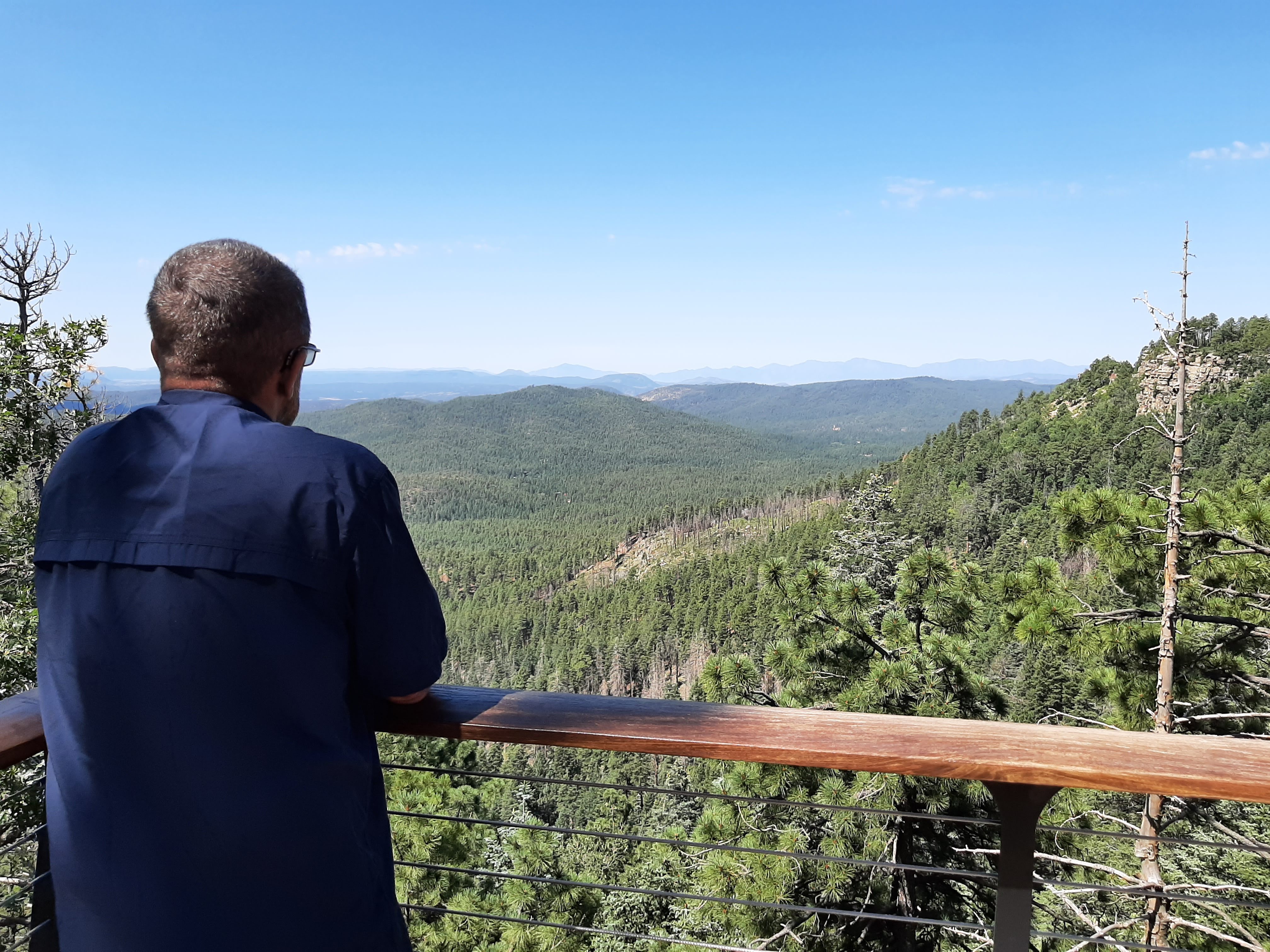


From the sublime to the much more crowded, we drove down into Payson, AZ, all of a sudden busy and congested after the wide-open roads of the past couple of days, and then from there through the Tonto National Forest to Phoenix. And the views just kept coming. I had no idea that Arizona was so mountainous, or so splendid.


Among the many things I didn't know about these cacti is that they grow only in the Sonoran Desert, which extends from southern Arizona and California into Mexico -- so when we began to see them, that meant that we were entering that desert. Some info about them: "The saguaro cactus is the largest cactus in the United States, and will normally reach heights of 40 feet tall. The tallest saguaro cactus ever measured towered over 78 feet into the air. The saguaro cactus grows as a column at a very slow rate, with all growth occurring at the tip, or top of the cactus. It can take 10 years for a saguaro cactus to reach 1 inch in height. By 70 years of age, a saguaro cactus can reach 6 and a half feet tall, and will finally start to produce their first flowers. By 95-100 years in age, a saguaro cactus can reach a height of 15-16 feet, and could start to produce its first arm. By 200 years old, the saguaro cactus has reached its full height, reaching upwards of 45 feet tall. Some saguaros have been seen with dozens of arms, while other cactus never produce a single one. Why this happens remains one of the desert’s mysteries."
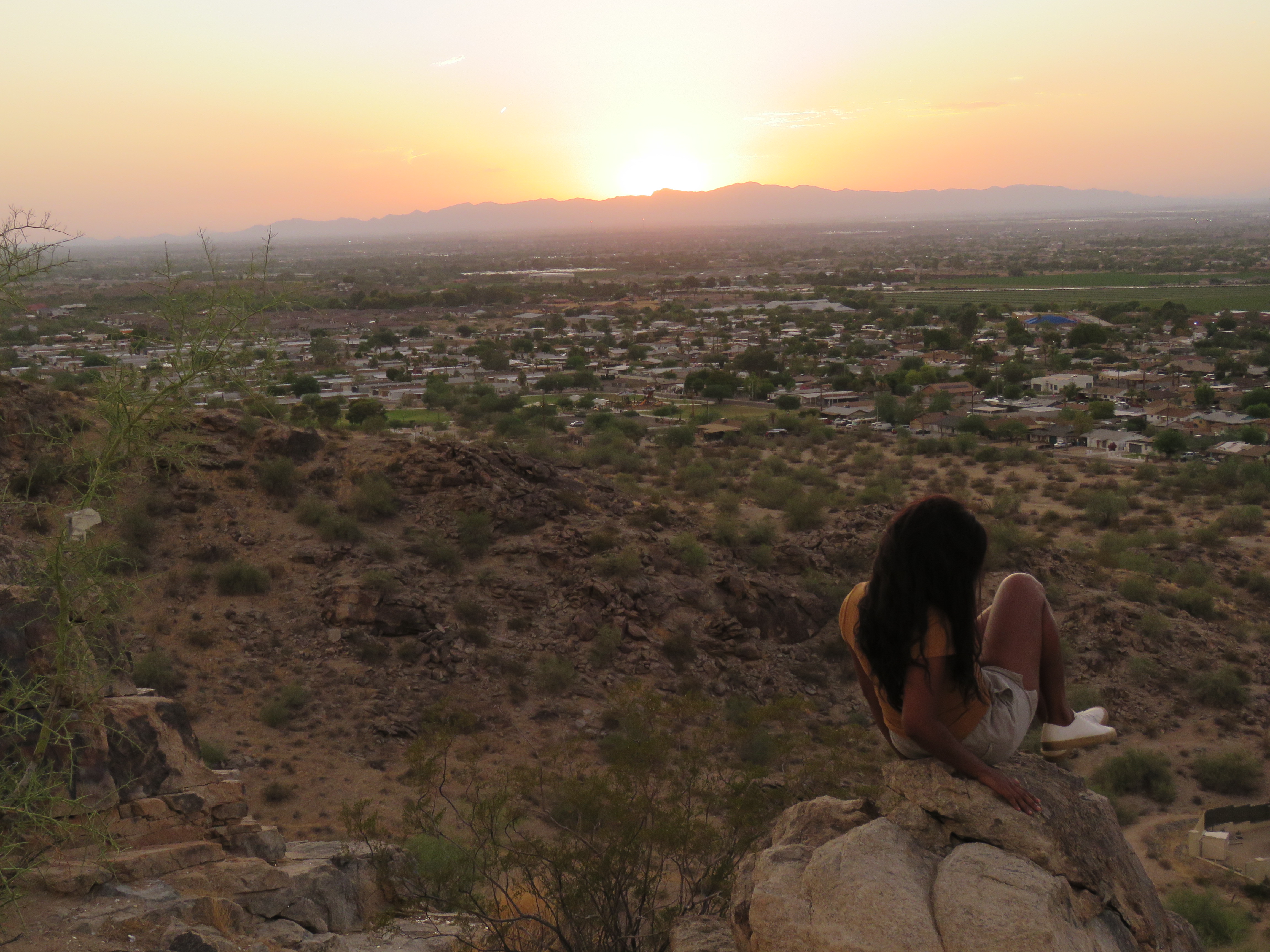
And then we got to Luke and Monica's. We spent a lovely afternoon relaxing with them in their pretty house, and then tried to see the sunset from Dobbin's Point, a mountaintop aerie with a view of all of Phoenix and its mountainous surroundings. Or so they tell us. We arrived about three minutes too late, third or fourth in a line of disappointed cars, as the park employee locked the gate for the night. But that turned out just fine. We parked nearby and scrambled up a rocky knoll to watch the sun sink behind yet another range of distant mountains. Mind you, it may have been evening but nonetheless it was still well over 100 degrees. The wind on your face is so warm! But the sunset was spectacular.


As it began to get dark, we noticed distant storm clouds and flashes of lightning in the southeast, and while we were driving home, our phones pinged with what turned out to be dust storm warnings. Dust storms! At home we hear about snow or wind or hail, but here we were warned of an approaching "wall of sand." By the time we got home (to a good dinner of meatballs made by Monica, plus you should taste her milk and coconut popsicles) the storm was approaching in a constant strobe-light show of lightning that went on and on all evening. We never saw a wall of dust, but instead, there was warm, wind-blown, heavy rain that -- if you stepped outside and let the hot wind blow into your face -- left grit in your eyes and teeth. Our first dust storm, our first Phoenix lightning storm and sunset, our first Arizona everything.
